
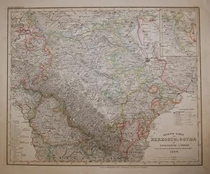
Neueste Karte von Herzogth. Gotha mit angränzend. Ländern. 1844. Gestochene, grenzkolorierte Karte 31 x 38 cm. (aus Meyer's Handatlas, Nr. 31)
Published by Hildburghausen Amsterdam ua Bibliogr Institut, 1844
From Klaus Schöneborn, Würzburg, Germany
AbeBooks Seller Since November 6, 2014
Seller Rating
![]()