MyTopo
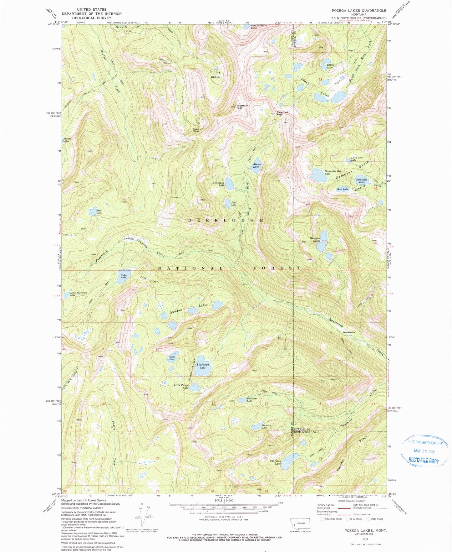
Classic USGS Pozega Lakes Montana 7.5'x7.5' Topo Map
Couldn't load pickup availability
Historical USGS topographic quad map of Pozega Lakes in the state of Montana. Typical map scale is 1:24,000, but may vary for certain years, if available. Print size: 24" x 27"
This quadrangle is in the following counties: Deer Lodge, Granite, Powell.
The map contains contour lines, roads, rivers, towns, and lakes. Printed on high-quality waterproof paper with UV fade-resistant inks, and shipped rolled.
Contains the following named places: Albicaulis Lake, Alpine Lake, Big Pozega Lake, Boulder Lakes Trail, Bowman Lakes, Caruthers Lake, Danielsville, Dead Lake, Dempsey Basin, Elbow Lake, Finley Basin, Fisher Lake, Goat Lake, Green Lake, Hunters Lake, Indian Meadows, Little Goat Lake, Little Pozega Lake, Little Racetrack Lake, Meadow Lakes, Mountain Ben Lake, Mud Lake, North Fork Racetrack Creek, Porcupine Lake, Powell Mines, Pozega Lakes, Racetrack Pass, Racetrack Peak, Thornton Lake, Thornton Ridge, Trask Lakes, Tungsten, Caruthers Lake Dam, Caruthers Lake, Mud Lake Dam, Mud Lake, Mountain Ben Dam, Goat Lake Dam, Thornton Lake Dam, Thornton Lake, Pozega Lake Number 3 Dam, Green Lake, Pozega Lake Number 1 Dam, Pozega Lake Number 2 Dam, Albicaulis Lake Dam, Alpine Lake Dam, Alpine Lake, Fisher Lake Dam, Bowman Lake Number 2 Dam, Middle Bowman Lake, Bowman Lake Number 1 Dam, Lower Bowman Lake, Bowman Lake Number 3 Dam, Upper Bowman Lake, Powell Mine, Daniels Post Office (historical)